Henry Hudson’s River
Curious about what lies on the Hudson floor along the Palisades? You would be amazed. On Sunday October 25th, the Palisades Library will be sponsoring a talk at 3:00 pm at the Esplanade on Oak Tree Road given by Dr. William Ryan entitled, “Mapping Our River in the Footsteps of Henry Hudson.”
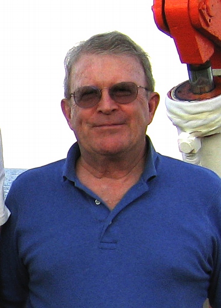
Bill Ryan is a Doherty Senior Scholar and Adjunct Professor Emeritus at Lamont-Doherty Earth Observatory and co-author of the book, Noah’s Flood: The New Scientific Discoveries About the Event That Changed History. A renowned researcher, much of Bill’s professional life has been spent at sea studying the ocean floor, particularly along the mid ocean ridges. Bill graduated from Williams College in 1961 and earned his PhD at Columbia University in 1971. Closer to home, Bill’s research led him to study the Hudson River.
We asked Bill to give us a synopsis of his talk.
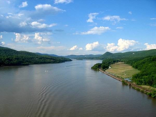
“Had Henry Hudson realized in the fall of 1609 that the native American name Muhheakunnuk for his “River of Mountains” meant “great waters constantly in motion,” he could have deduced that it was not a river but a giant estuary influenced by twice-daily tides as far inland as its first cataract. Within a decade, mariners of the East India Company had charted the estuary with lead line soundings all the way to this cataract at Troy.
Ten years ago a team from the Lamont-Doherty Earth Observatory repeated the Dutch survey, but instead of just obtaining a hundred or so soundings, we recorded millions. About every square yard of the river bed deeper than six feet now has its own sounding. Examples of the new maps will be on display and illustrated in the talk.
In addition to soundings, the Lamont researchers also obtained several hundred sediment cores of the riverbed mud and sand. The cores and soundings revealed oyster beds, some buried, but many still exposed extending from the New York Harbor to the Newburgh- Beacon Bridge. The location of these beds turned out to be fascinating. The top of the exposed beds is very firm mud that provides unsure footing for mooring and anchors. The river edge towns settled by the Dutch were always located between the beds, so that their ship captains could be assured of a good anchorage. Thus the riverbed itself determined settlement patterns.
My talk will show that shape and content of the Hudson and East Rivers even determined the street plans for the 17th, 18th and 19th century development of Manhattan.
The excavations for the building of the World Trade Center beginning in 1966 and the disposal of soil and rock for the foundations of Battery Park City at the river’s edge on the west side of Lower Manhattan has constricted the river causing it to cut a new and deep channel farther towards New Jersey. This down-cutting is a potential threat to the security of the Lincoln and Holland tunnels. Had the Port Authority of New York and New Jersey appreciated the power of the ‘great waters constantly in motion,’ perhaps they would have had more foresight.”
Mark your calendars for October 25th at 3:00 pm and be sure to sign up at the Library. Bill’s past Hudson River talks have been standing room only.